


By John Keefover of Keefography
SHT THRU-HIKE RECAP CHAPTER 6: DAY 16-19
Trip report from my Northbound Thru-Hike of the Superior Hiking Trail in June 2022.
In June of 2022 I Thru-Hiked the Superior Hiking Trail going Northbound. During the hike I filled 3 journals worth of notes, stories, trail conditions, and thoughts to be paired with photos take along the way. I enjoy sharing my adventures in hopes of inspiring others to get outside and experience it for themselves. For general information about the SHT itself see my other blog: HIKING AND BACKPACKING THE SHT. If you’re interested in planning your own trip on the SHT you should check out the SHT THRU-HIKE ITINERARY I wrote as well. For all of you gear nerds out there take a look at my GEAR LIST FOR THE SHT.
This is a more thorough Trip Report than the Itinerary I posted, and covers the last 3 days of the hike. To see the rest of the trip see the links below.
If you enjoy this free content please consider making a CONTRIBUTION, buying my 2023 PHOTOGRAPHY CALENDAR, purchasing PRINTS, and following along on Social Media at Instagram, Facebook, & YouTube. Your support is greatly appreciated to help cover travel costs, permits, gear acquisitions, and time commitments needed to get outside and share these adventures with you all. Thank you!
CHAPTER 6: DAY 16-19
DAY 16: MONDAY 6/27/22
Total Mileage: ~22 Miles. North Bally Creek Pond Campsite - Kadunce River Campsite. 3 tent pads. Water from Kadunce River.
It was very cold this morning. I’ll double check the weather when I get service in town, but I don’t think it’s going to heat up much at all until I’m done with the hike. Last I saw it was a forecasted high of mid 50s and lows on the 40s. Before leaving the campsite I checked out the pond. There was no wind today so it was still and had beautiful golden light on it and the trees. Not far from the campsite you cross the creek that feeds into the pond. The boardwalk is starting to fall apart, but they have plans to rebuild it soon in the same style as the boardwalk over Sawmill Creek Bog back at Section 13. The materials for the rebuild were already there even.

Morning light at Bally Creek Pond
After that there’s really nothing at all until Grand Marais. Well except for the few terrible miles of snowmobile trail the SHT shares paths with again. So much road walking and snowmobile trails along the SHT. Finally I got to Grand Marais. At the Pincushion Mountain trailhead I took in the view overlooking the harbor town next to Lake Superior.

Grand Marais, Minnesota as seen from the Pincushion Mountain parking lot.
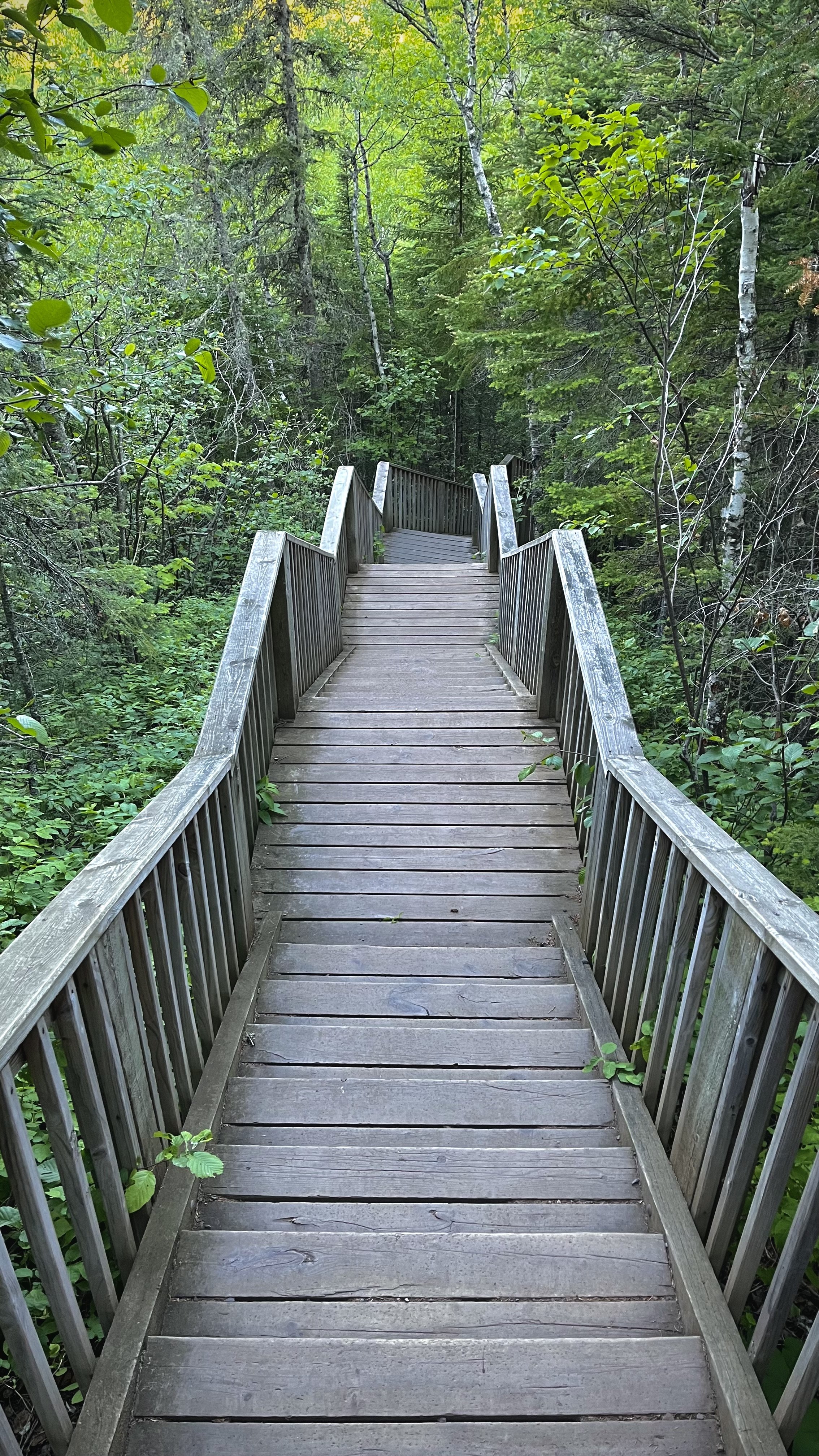
This is my last re-supply point for the trail here too. I was to meet local photographer Emily Running here who had a food bag I gave her before the hike. I arrived here early though so as I was waiting for her I unpacked my bag to dry my stuff out in the sun and take a break. Once Emily showed up I stocked up my bag ready for the home stretch! I loved this section of trail through Pincushion Mountain. It feels quite different from the rest of the SHT. The trail is very dry and dusty in comparison to the muddy stretches I’ve hiked. It’s been awhile since I’ve been through here. In recent years they’ve built an extensive immaculate boardwalk that made it a breeze walking through.

Boardwalk through the Pincushion Mountain trail system.
Then the mountain drops down into the Devil Track River Gorge. The canyon walls are really impressive, as is the A-Frame bridge over the river. There are 2 really nice campsites here right on the river as well. I was planning on staying here tonight but it was so early in the day I wanted to keep pushing on. The trail climbs back out of the gorge with occasional glimpses at the canyon below.

A-Frame bridge over the Devil Track River gorge.
There’s another marked overlook here too called “Unimpressive Overlook” and they couldn’t have picked a better name for it. There was nothing there. Don’t even think it was an overlook at any point. After following Woods Creek for sometime the trail puts you out on the aptly named Wildflower Hill. Beautiful wildflowers covered the whole hillside which had a great view of Lake Superior.
There are many more creeks to cross today including Durfee Creek, Kimbal Creek and Crow Creek all before I got to the Kadunce River which I’m planning on staying at tonight. When I got to the site there was an older gentleman there named Kevin already set up with a fire going. Before joining him around the fire and I did all my camp chores including back down to the river to filter more water. The Kadunce is an amazing river going through a lush mossy slot canyon further downstream. I wasn’t planning on exploring it much today though at the end of this long day. Kevin & I had dinner around the fire and talked before we both went to bed early after putting out the fire.

Wildflower Hill overlooking Lake Superior.
DAY 17: TUESDAY 6/28/22
Total Mileage: ~10 Miles. Kadunce River Campsite - Judge C.R. Magney State Park Campground. $30 for a site. Shower, bathrooms & drinking water available. Reserve your site here: https://reservemn.usedirect.com/MinnesotaWeb/.
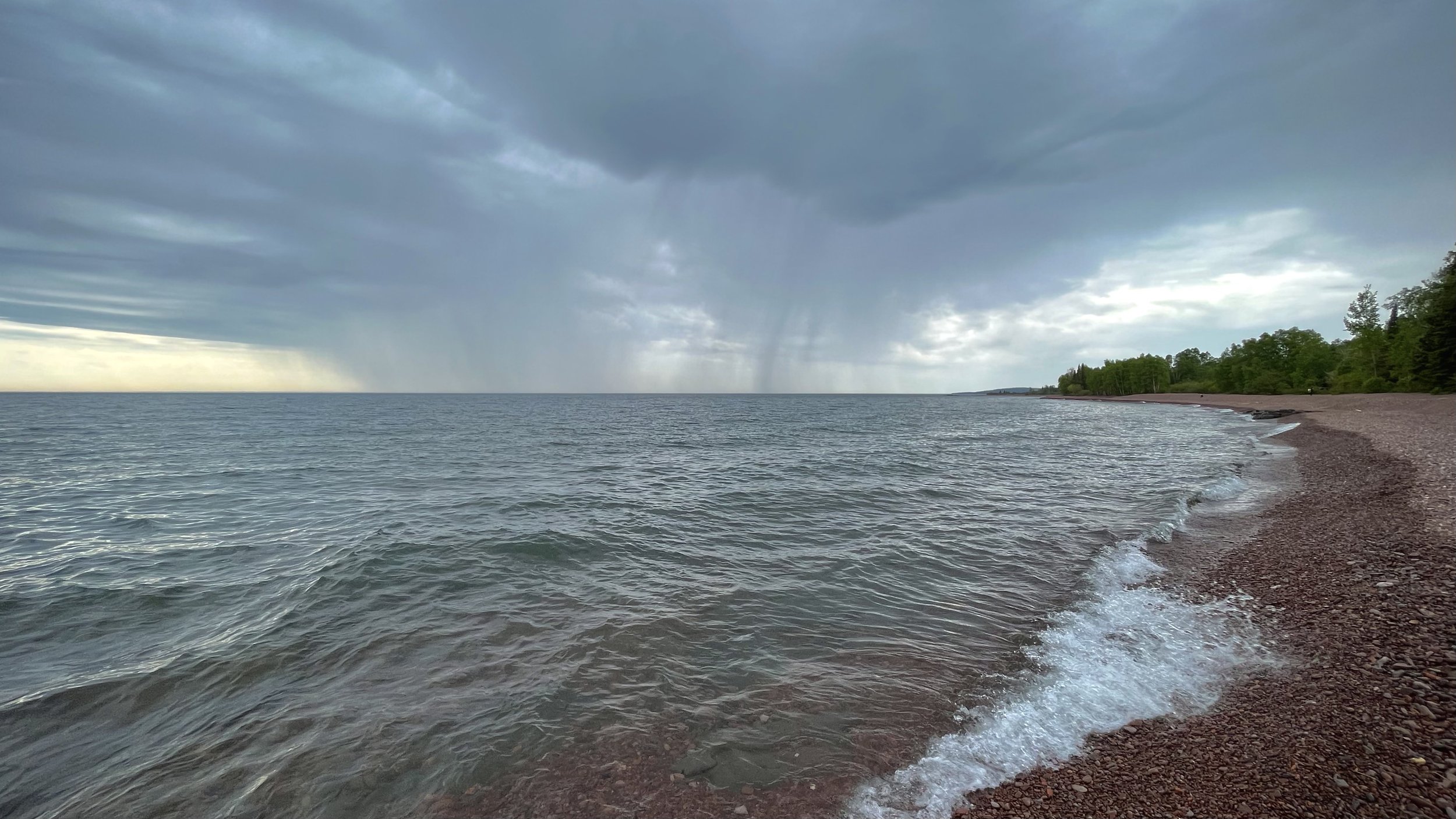
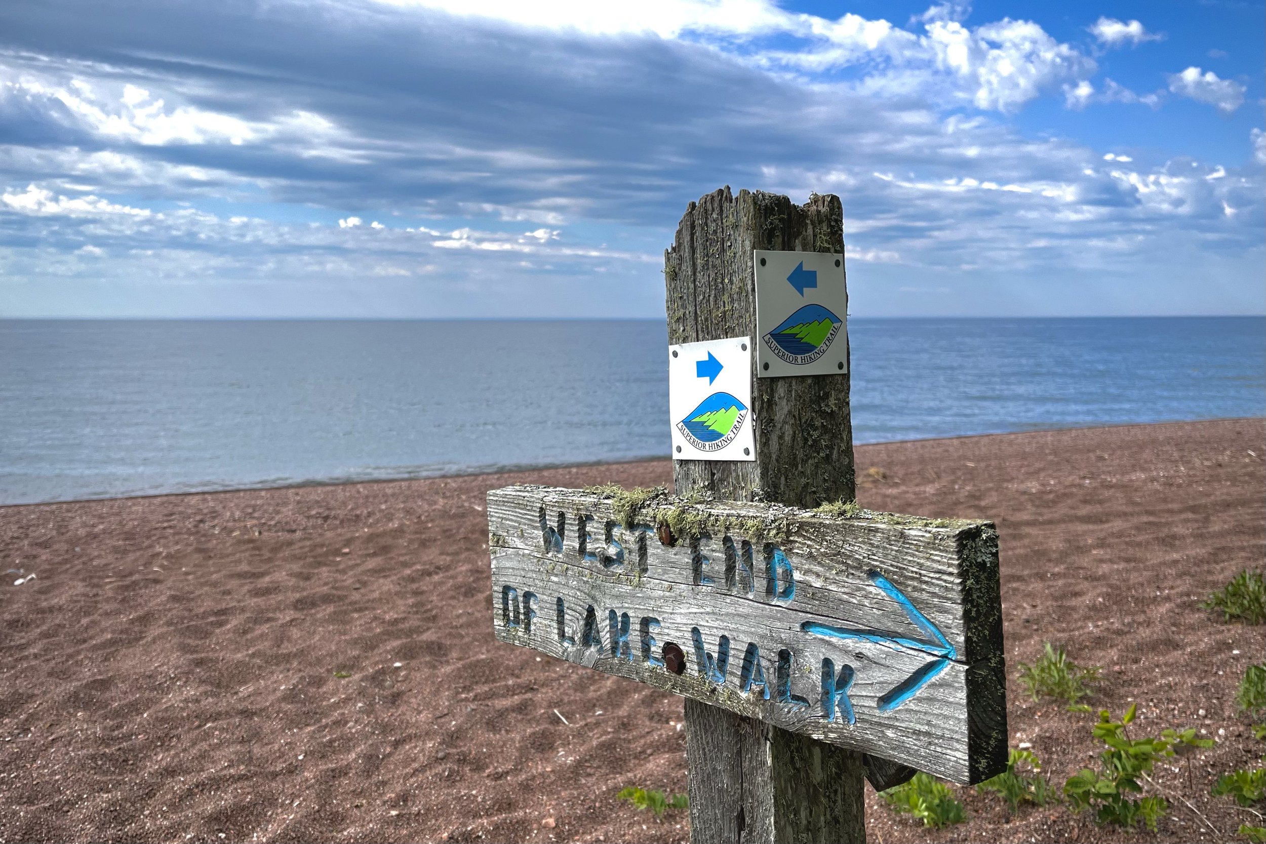
Today is going to be a short day on trail as I get ready for one last big push. Yesterday I decided to book a campsite at Judge C.R. Magney State Park for an easy day. Plus there’s a shower! I’ll also be a little closer to my campsite tomorrow which will be Jackson Creek 21 miles away. After leaving the Kadunce River the trail soon comes to the Lake Walk section. As I got there a storm started rolling in over the lake. It stayed mostly to the south but I did get rained on a little bit and it was a little colder with the wind coming right off the lake. The lake walk is beautiful and unique, but man those pebbles hurt your feet and really slow you down! I don’t wear gators on my feet but they would come in handy here keeping the rocks out of your shoes. A few people were out looking for Agates and beach glass. I met someone named Tyler hanging out on the beach who said he was a big fan of my photography and has been following along with the through hike as he finishes section hiking the trail himself.

Walking over miles of pebbles

The beach eventually turned to reveal the Tombolo, which is a picturesque little tree studded Island right off shore that is sometimes connected by a small strip of sand. It was just about connected today as the water is pretty low. I’ve photographed this island several times in many different lighting conditions and it’s always a fun one to shoot.

The Tombolo off of the Lake Walk Section of the SHT
Right after the Tombolo there’s a boardwalk with a sign marking the lowest elevation on the trail at 602 feet - Lake Superior. I’m the last day of the trip I’ll be on the highest point of the trail at 1,829 feet. The highest point in Minnesota is Eagle Mountain at 2,301 feet. After the boardwalk the trail crosses Highway 61 and is back in the thick woods. It was lovely after the lake walk section! The passing rain saturated the vegetation and made everything feel more vibrant in here.

Not much of note through this part. I’ve hiked this section before and it’s mostly just a green tunnel in the woods. There are some creeks and a river but this time of year it’s pretty dried up. There are 3 campsites on the Little Brule here that are decent, but I was headed for the public campground. Once I arrived I kind of regretted it. Felt weird being around so many people, families, crying babies, barking dogs and RVs all around. The day is still early too so I definitely could’ve pushed on. It would’ve been a big push though as the next campsite is Hazel in 9 miles. That site kind of sucks though. It’s small, has no water and is a popular destination because of the campsite gap. Staying at the campground was worth it to shower though! Even just rinsing off was a refresher. Thankfully the babies in the campground all fell asleep after dark and so did I soon after.
DAY 18: WEDNESDAY 6/29/22
Total Mileage: ~20.5 Miles. Judge C.R. Magney State Park Campground - Jackson Creek Campsite. 3 tent pads. Water from creek.
Woke up at 4:30 to hit the trail early even though I didn’t sleep very well. Have a big day through rugged terrain and downed trees. Before I left the campground I used the luxury of the bathroom and filled up on drinking water. It was really cold again this morning at 43 degrees. I started hiking as soon as I could just to warm up. First thing there’s a big bridge over the Brule River. Morning light was just hitting the tops of the trees on the other side of the river.

Morning lights on the tree tops along the Brule River at Judge C.R. Magney State Park
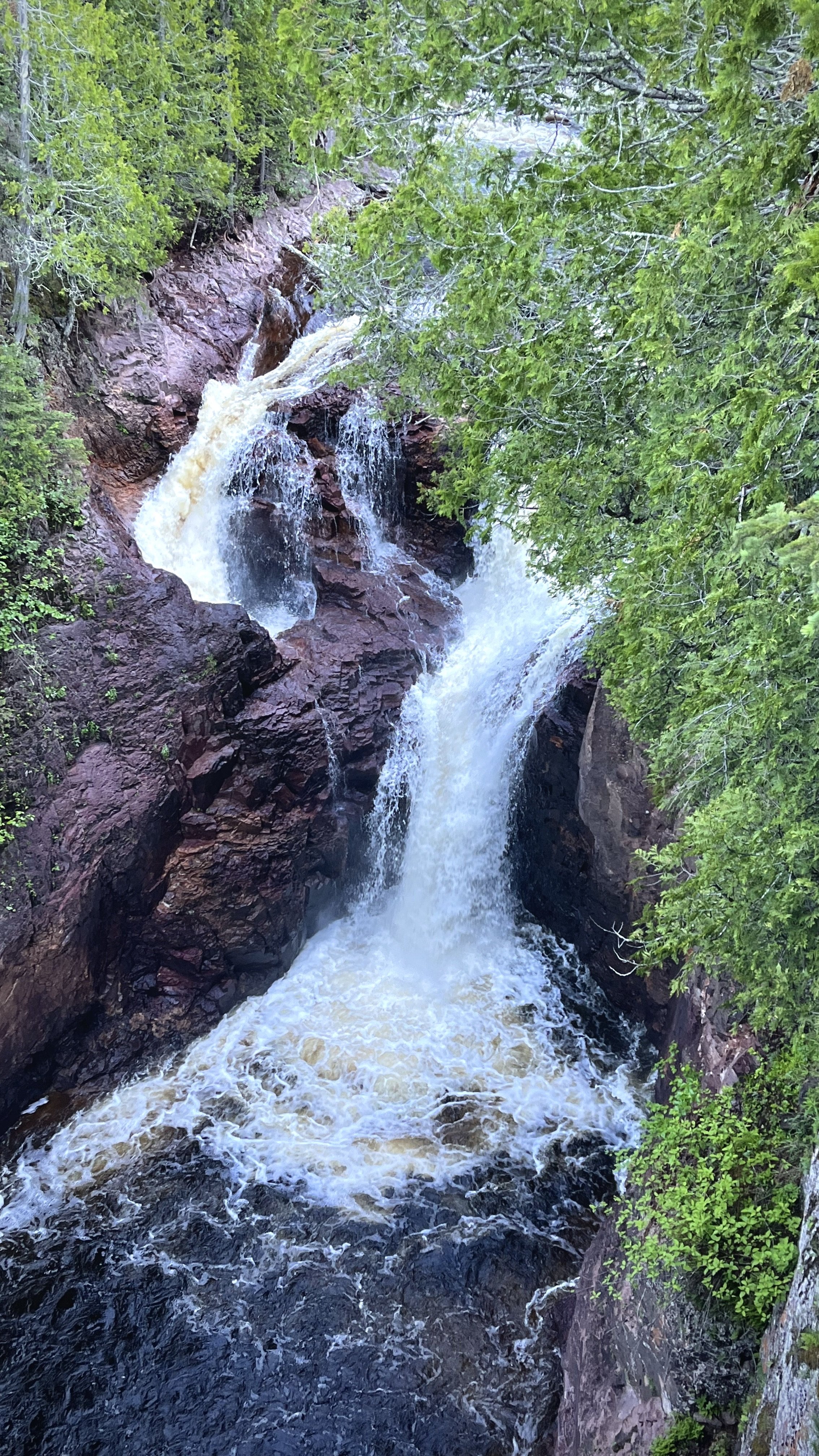
I’ve hiked here many times before in the way to Devil’s Kettle which is a mile up the river. There’s also 192 wooden steps down to the river. I only know that because someone write the count at the top of the stairs. The river got hit really hard this spring with flooding and erosion. The walkway to Upper Falls was completely destroyed and trees piled up on the shore making it an awkward scramble to get down there. I skipped by even though Upper Falls is better than Devils Cascade up ahead. Devils Kettle is cool because of the “mystery” surrounding both separate chutes of waterfalls and where the one disappears to into the rock. There’s a tree that’s grown in quite a bit blocking the view though.
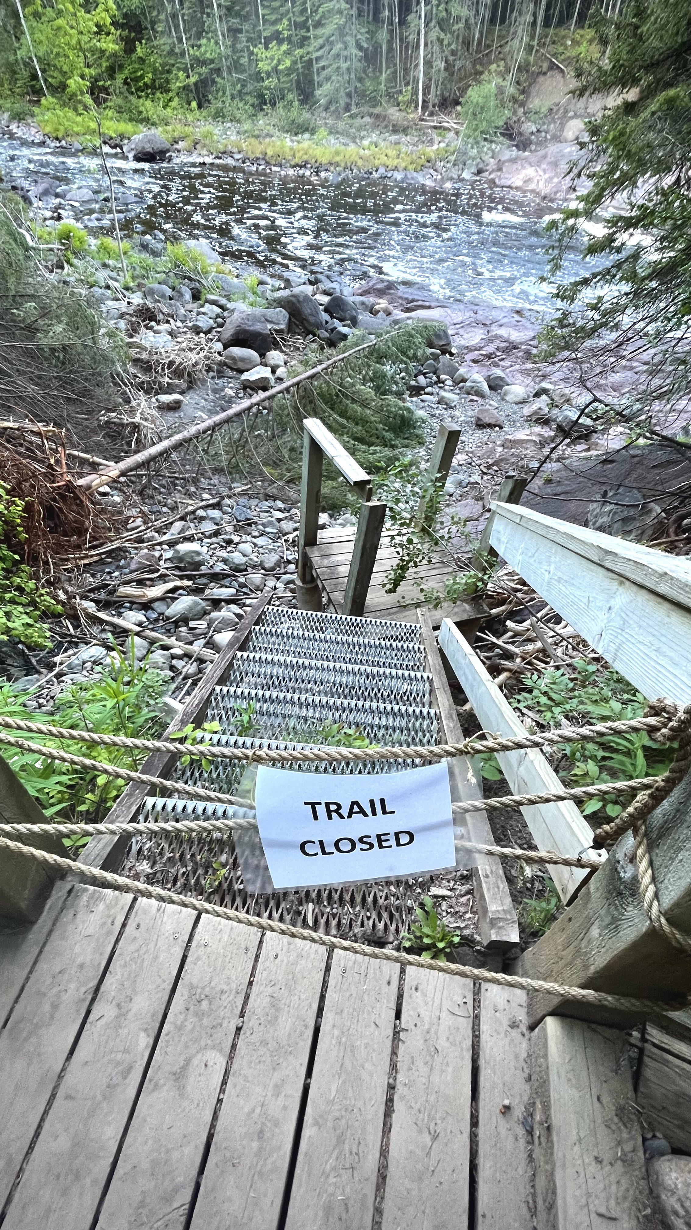
This is now the furthest north I’ve been on the SHT! How fitting there’s a sign saying trail is closed… On the SHTA Trail Conditions page says the trail is actually open to thru and section hikers but not recommended to day hikers. It’s a bit difficult currently after the spring floods threw trees and boardwalks everywhere and eroded the trail away in spots along the river. It wasn’t too bad though especially if you look for where previous people have gone around obstacles. It did take awhile to get through that mess and leave State Park property behind. Almost immediately after leaving Judge Magney there’s a road walk for 2 miles on a dirt road.
After the road walk the section of trail was very overgrown. The dew from the early morning clinging to the brushes and soaked my pants and shoes as I walked through. I got to the Hazel campsite and went straight past it. Nothing special. Another road walk awaited me though this time it’s more of 4 wheeler trail. At least it’s in much better shape than the snowmobile trails I had to hike through on this trip! That is until I got to a part that’s completely flooded out by beaver activity. There’s an official flagged reroute around it though. I’ve heard it’s pretty hard to spot when you’re heading south in the other direction just a heads up for anyone planning a SOBO hike.

Flooded section has an official reroute around it.
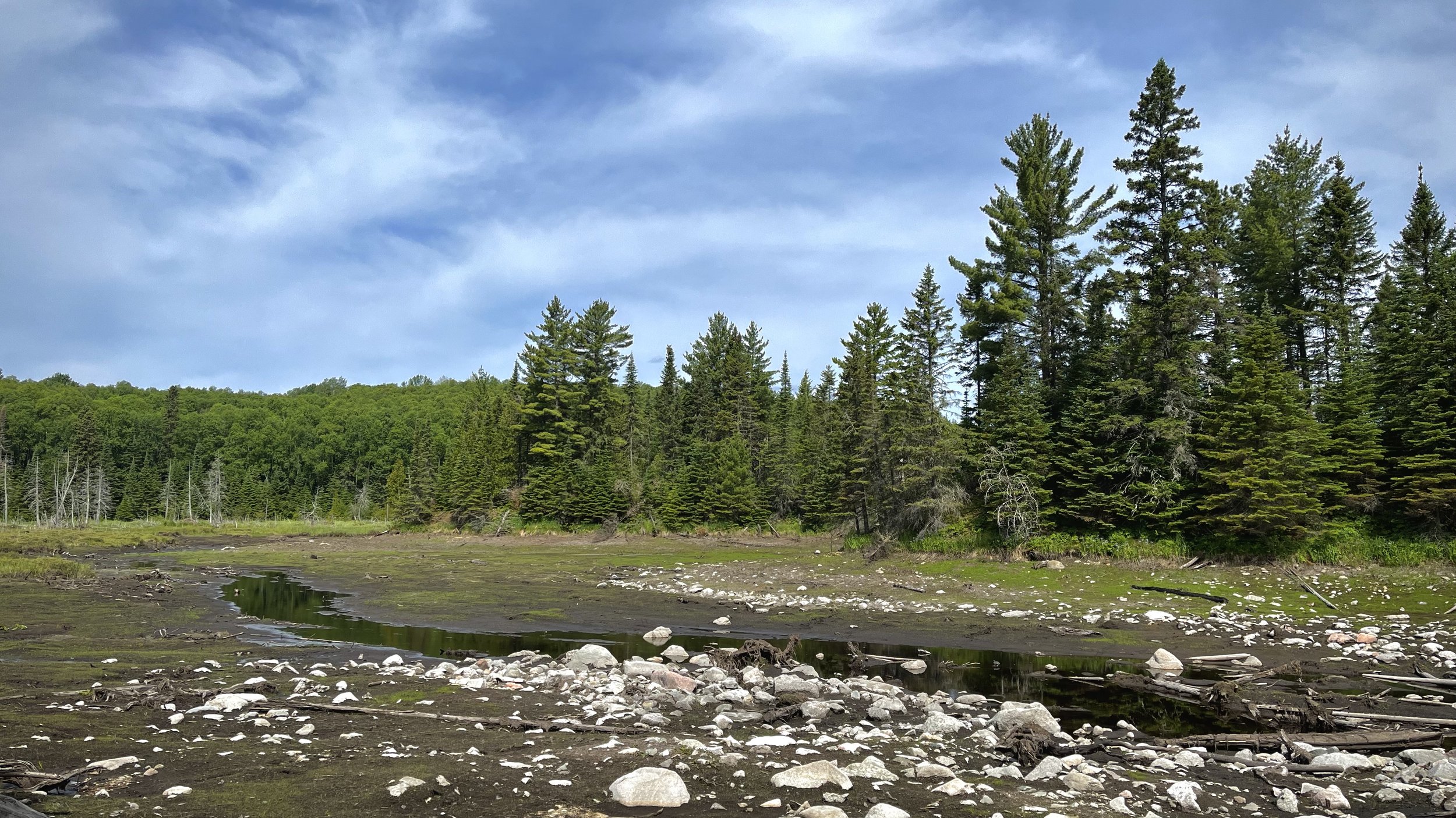
Once back on trail again it leads to South Carlson Pond campsite. It’s actually a really nice site up on a wooded hilltop, but unfortunately the pond is almost entirely dried up. More beaver activity. The waterbed was dry mud racks and the vegetation was withering away. I crossed the Arrowhead Trail and got to the North Carlson Pond Campsite. I didn’t like this site as much but at least the pond here had some water in it still. I did see a big ole beaver on dry land though working on something.
I eventually got to Carlson Creek where there is a trailhead parking lot on the other side of the creek. The floods this spring destroyed the bridge over to it so it’s a bit of a scramble over debris and rocks if you do need to get across.

Bridge over Carlson Creek from the trailhead to the trail destroyed in the spring floods.
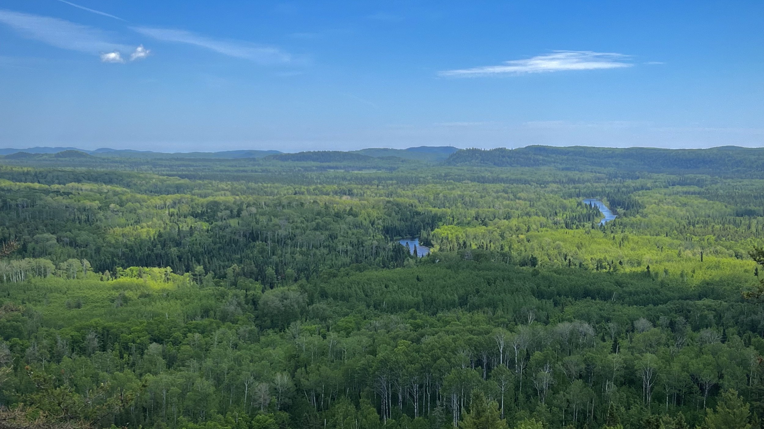
The next section of trail was my favorite of the Northern end, so far at least! The trail ascends along a ridge line leaving the swampy green tunnel behind. There’s an amazing view near the “Hellacious Overlook” marker. Really the view is better before you get to the marked spot. The trail was busy with people heading Southbound. I ran into around 15 people including Maps & Poptart again! They got to Grand Marais and then got a ride to the Northern Terminus where they’ll make their way back to Grand Marais, which is calked flip-flopping in hiker lingo. It was good to see those two one last time. We caught up on our adventures and then parted ways again.

Hellacious Overlook with rolling hills next to Lake Superior
The last couple of miles seemed to take forever. I kept running into people and talking along the way! So strange the area I see the most amount of people is in the most remote section. I was just telling one of the other hikers that we’ve had great weather and I’ve not once had to set up the tent in the rain. I just had to say that huh? It started pouring right after! It’s ok though I can deal with it for the last night!

Had to say it didn’t I?
I set up camp at Jackson Creek which was a pretty lovely spot. Most of the ground here though is solid rock or a tangle of roots which made pitching the tent a bit of a struggle. I was the only one there though which was nice. During a brief break in the rain I cooked up some dinner and hung my bear bag before it started to rain again and I retreated to the tent. As I listened to the sound of rain falling on the tent I caught up trail notes from today. Looking back it would’ve been nice to stay at Woodland Caribou Pond campsite. It was a really neat site with tons of evidence of beaver activity with downed trees literally lining the entire shore. Pretty much everyone I talked to on trail was planning on staying there though so it would’ve been packed. I’m happy with where I’m at all by myself and plus I’m much closer to the end tomorrow now! Signing off for the last push in the morning!

View from the Woodland Caribou Pond campsite
DAY 19: THURSDAY 6/30/22
Total Mileage: ~9 Miles. Jackson Creek Campsite - Northern Terminus
Over the night the rain picked up and turned into a really nasty storm with constant lightning and immediate booming thunder. I actually saw a massive bolt almost directly overhead my tent and got a notification from my weather app that the closest lightning strike was 0.15 miles away. The SHT gave me a heckuva send off! Besides waking up to the storm I slept great. It just set in that it’s the last day now! I’m thankful that I won’t have to put on cold, wet toe socks in the morning for some time after this… By the time I got going it was still rainy and foggy. There was lots of deadfall after the campsite from other storms too which made for a bit of a scramble right away in the morning. I did get a neat view of Jackson Creek before heading up on the ridges.

Jackson Creek in the fog
The trail continues up and up to the top of Rosebush Ridge which is the highest point of the Superior Hiking Trail at 1,829 feet. You wouldn’t know it if not for the sign since it’s completely grown in here. Once I got down from the ridge it was very swampy and overgrown. The bugs were absolutely terrible. Moose scat was dotted along the trail and I came upon some very fresh looking bear scat. I made my presence known after that talking and singing out loud to myself.

The bridge over Andy Creek was another victim to the spring flooding. The SHTA noted that it was still crossable with caution so I took it slow across the leaner.

Andy Creek bridge is still crossable but has a wicked lean to it. Use caution.
Shortly after that the trail merges with what looks like a 4x4 trail or snowmobile trail until the northern trailhead. It was actually a nice change of pace after the state of the trail I just went though. My partner, Julie, was waiting for me at the northern trailhead to pick me up. First we walked to the Northern Terminus together to finish the hike. This trailhead here is shared with the Border Route Trail. The BRT is a rugged 65 mile wilderness trail in the Boundary Waters Canoe Area Wilderness and I’ll be hiking it in October with a few other backpacking YouTubers! Stay tuned for that content coming up. For now we hiked up to the Northern Terminus sign where of course I had to take a picture with it. I mean did you even hike the trail if you didn’t take a picture with the sign?

Posing with the Northern Terminus sign after completing my Northbound Thru-Hike
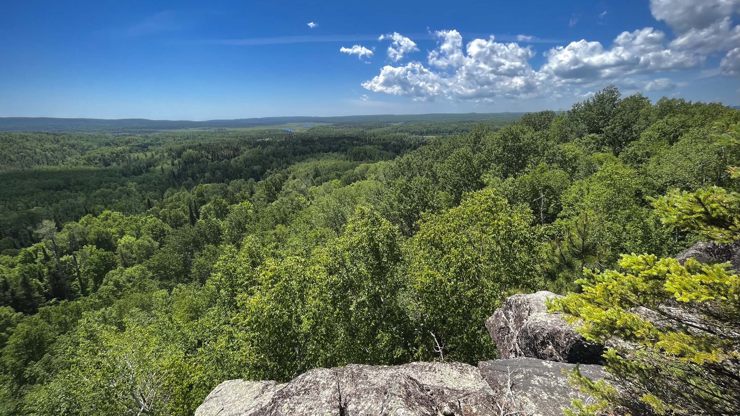
I signed the last trail registry book and we preceded to check out the 270 Degree Overlook at the very end of the trail. Here you have an amazing view of Canada off in the distance with rolling hills and a river winding through the landscape. We sat in the rocks for a bit taking in the view and catching up on what’s been going on since we’ve been a part for so long. I missed her of course, but I also feel proud, accomplished, tired, sore, and yet Re-charged at the same time.
We hiked back to the trailhead and headed south to Grand Marais where we booked a hotel for the night. We also took a sauna at Sisu + Löyly Nordic Sauna right on the lake to really relax. Watching the sunset from inside the sauna was a great way to end the trip!

Sunset in Grand Marais over Lake Superior from the the Sisu + Löyly Sauna
Thanks to everyone who donated to help support this hike and the Wolf Ridge ELC Fundraiser as well- we raised $1,725 for them! Special thanks to those who helped with my food re-supplies along the way: my mom, my partner Julie, Justin, Joe, Chuck & Emily. Thanks to all of you reading this story also! Hope you enjoyed it and helps inspire you to get outside. Onto the next adventure!

Celebrating the end of the hike at the 270 Degree Overlook
Trip Report from backpacking the 42 mile long Pictured Rocks National Lakeshore Trail. It follows sandy beaches and dramatic cliffs along Lake Superior in the Upper Peninsula of Michigan.