


By John Keefover of Keefography
SHT THRU-HIKE RECAP CHAPTER 2: DAY 4-6
Trip report from my Northbound Thru-Hike of the Superior Hiking Trail in June 2022.
In June of 2022 I Thru-Hiked the Superior Hiking Trail going Northbound. During the hike I filled 3 journals worth of notes, stories, trail conditions, and thoughts to be paired with photos take along the way. I enjoy sharing my adventures in hopes of inspiring others to get outside and experience it for themselves. For general information about the SHT itself see my other blog: HIKING AND BACKPACKING THE SHT. If you’re interested in planning your own trip on the SHT you should check out the SHT THRU-HIKE ITINERARY I wrote as well. For all of you gear nerds out there take a look at my GEAR LIST FOR THE SHT.
This is a more thorough Trip Report than the Itinerary I posted, and covers days 4-6 of the hike. To see the rest of the trip see the links below.
If you enjoy this free content please consider making a CONTRIBUTION, buying my 2023 PHOTOGRAPHY CALENDAR, purchasing PRINTS, and following along on Social Media at Instagram, Facebook, & YouTube. Your support is greatly appreciated to help cover travel costs, permits, gear acquisitions, and time commitments needed to get outside and share these adventures with you all. Thank you!
CHAPTER 2: DAY 4-6
DAY 4: WEDNESDAY 6/15/22
Total Mileage: ~28 Miles. My House - Sucker River Campsite. 4 tent pads. Water from Sucker River.
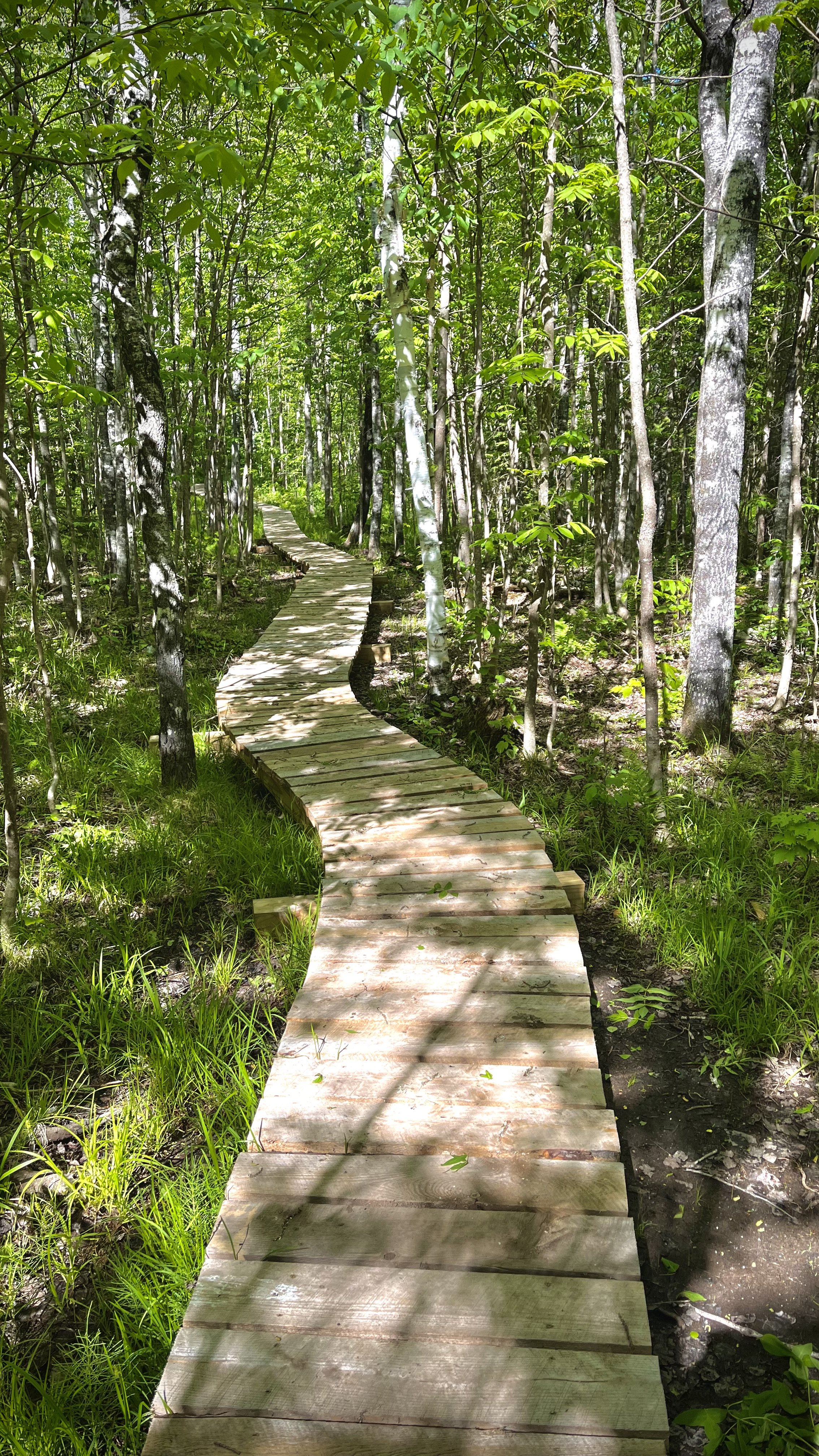
I got up at 5 AM and made a big ole scrambled eggs breakfast to fill me up before heading out. Julie brought me to the nearby trailhead at Chester Park and hiked with me for the first mile or so. Living so close to the trail here I’ve walked through Chester many times before so not much stood out to me now. It is a nice trail for being right in the middle of town though with lots of little waterfalls. There was also a lot of road walking in this section. Especially right after Hartley Park where you actually walk down a dirt road through the middle of a cemetery which is kind of weird… After that though you get into Downer Park which has an entirely different feel to it than the rest of the SHT so far. Crushed red rocks covered the trail and reminded me of the mine pits around my hometown of Hibbing on the Iron Range. I was looking forward to the next section of trail because there’s no elevation for many miles. That optimism was quickly dashed when I realized the hiking trail actually follows along with the North Shore State Snowmobile Trail and with the heavy rain and prolonged spring we had it was completely flooded and overgrown. So though the trail was flat it sucked. There wasn’t much signage at all either which made the myriad of road walks and crossings a bit confusing at times. At least I was able to crank out the miles through here.
I arrived at my originally planned campsite after 24 miles but decided to keep on pushing on to the next one in 4 miles to shorten the next couple big days. 28 miles became my personal biggest mileage day on trail! I ended up on the Sucker River campsite which has a nice little spot on the river where you can soak your feet in the water and where I had dinner. When I got to camp late in the day and in the rain there was another person already there. All of the SHT sites are to be shared with others as long as there’s room. Finally the sun started to come out now too! I’ve had pretty crappy weather so far with rain and temps ranging from the 40s to 60s. That’s the North Shore for you even in the summer time. Lake Superior often acts as a natural air conditioner. It’s supposed to start getting really hot and nice starting tomorrow though!

Del’s Pond north of Duluth.
DAY 5: THURSDAY 6/16/22
Total Mileage: ~22.5 Miles. Sucker River Campsite - Stewart River Campsite. 5 tent pads. Water from Stewart River.
Though I tossed & turned throughout the night again I slept great actually. Turns out hiking 28 miles will tire you out. By the time I was on the trail again it was 8 AM, later than I was hoping which seems to be the trend so far. This day was fairly uneventful but I’m just glad there was no more snowmobile trail for now! There was a lot of road walking again later on but we’ll get to that later. I was pushing hard again today aiming for a campsite in 22 miles. Soon I came to Fox Farm Pond which is a local favorite spot of mine that I visit frequently. In fact you can watch a vlog I made here where I camped here during a blizzard! The beavers there have really been busy damning up the shoreline since I was last there.

Fox Farm Pond.
On the map was “12 Mile View” which I was interested in but when I got there it was completely grown in, or they’re just trolling us. There was just trees everywhere, it didn’t even look like it was a vista at any point. McCarthy Creek was a lovely little spot though with a little waterfall with a footbridge next to it. Perfect spot to take a break and filter some water and eat a snack. I was originally planning on staying at the campsite there too, but again decided to keep pushing on. There were a few more landmarks coming up on the map. The first was “Epic Tree Stand” which I didn’t see anywhere. Not sure if it was destroyed or maybe I just cruised on past it without realizing. The next landmark was the Mining Test Pit. It was a very old pit which was now just a caved in hole in the ground.

“12 Mile View”

Just a glimpse of some of the muddy trail.
The last stretch to the campsite felt like it was the muddiest and buggiest section yet. Maybe I was just tired and over it after hiking 50 miles these last two days. Once I got to the Stewart River Campsite I decided to stop there for the night. It’s a nice site next to the quick moving river with a pretty pedestrian bridge over it. The bugs were still terrible though. I ate the rest of the day’s food quickly before retreating to my tent. I was the only one at this campsite. That was until I was about to fall asleep around 9:30 when I started hearing noises in the dark and saw headlights coming down the trail. It was two other Thru-Hikers I met earlier in the day, Maps & Poptart. We ended up leapfrogging each other quite a bit throughout our hike. They called me the Hare because I would leave them behind and then they’d end up catching up to me at the same random campsite later on. We’re all going to be re-supplying at the nearby Trailhead off highway 2 north of Two Harbors tomorrow.
DAY 6: FRIDAY 6/17/22
Total Mileage: ~18.5 Miles. Stewart River Campsite - Crow Valley Campsite. 6+ tent pads. Water from small stream.
In the morning we all talked for a little bit before the girls headed off for their re-supply. I had time before I was supposed to meet my friend Justin, who had to bail from the hike due to injury, for my next re-supply. I hung out by the river for a bit until the bugs became too much and I hit the trail as well. Not much to note here through to the Highway 2 Trailhead besides catching up to the ladies again. We walked to the trailhead together where one of their moms was waiting with their little Aussie puppy. Justin was running late for my re-supply so we changed plans to meet at the next trailhead and I kept on hiking leaving Maps & Poptart behind, for now. It was mostly all road walking to the next trailhead. There was an issue with a private landowner where the trail passed through so the trail was closed at that point and re-routed around on the backroads for miles. Towards the end of the road walk and near the Fors Road Trailhead I met a man doing some yard work on the edge of his property. He stopped what he was doing to chat and welcome me to the area. He owns the land the trail passes through for the next mile and appreciates all the hikers enjoying it. Thanks to all the private landowners that allow the trail access through their property! Please respect the signs and private property by staying on trail so they don’t revoke access and the SHTA doesn’t have to reroute around it.
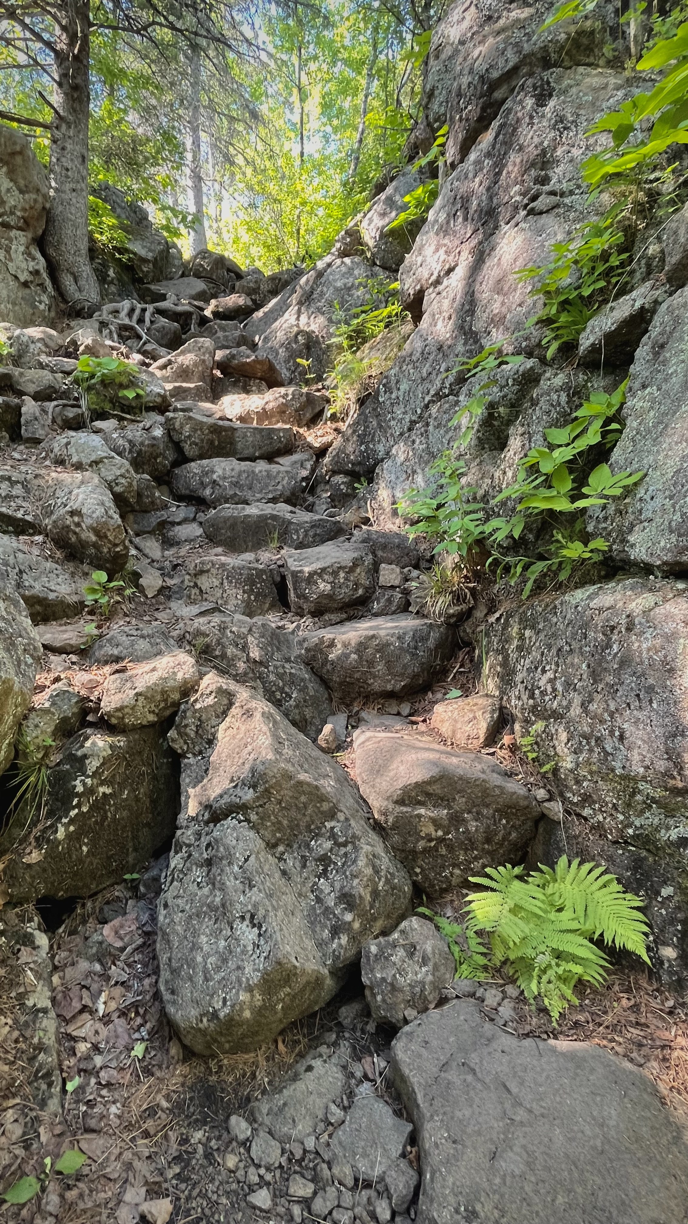
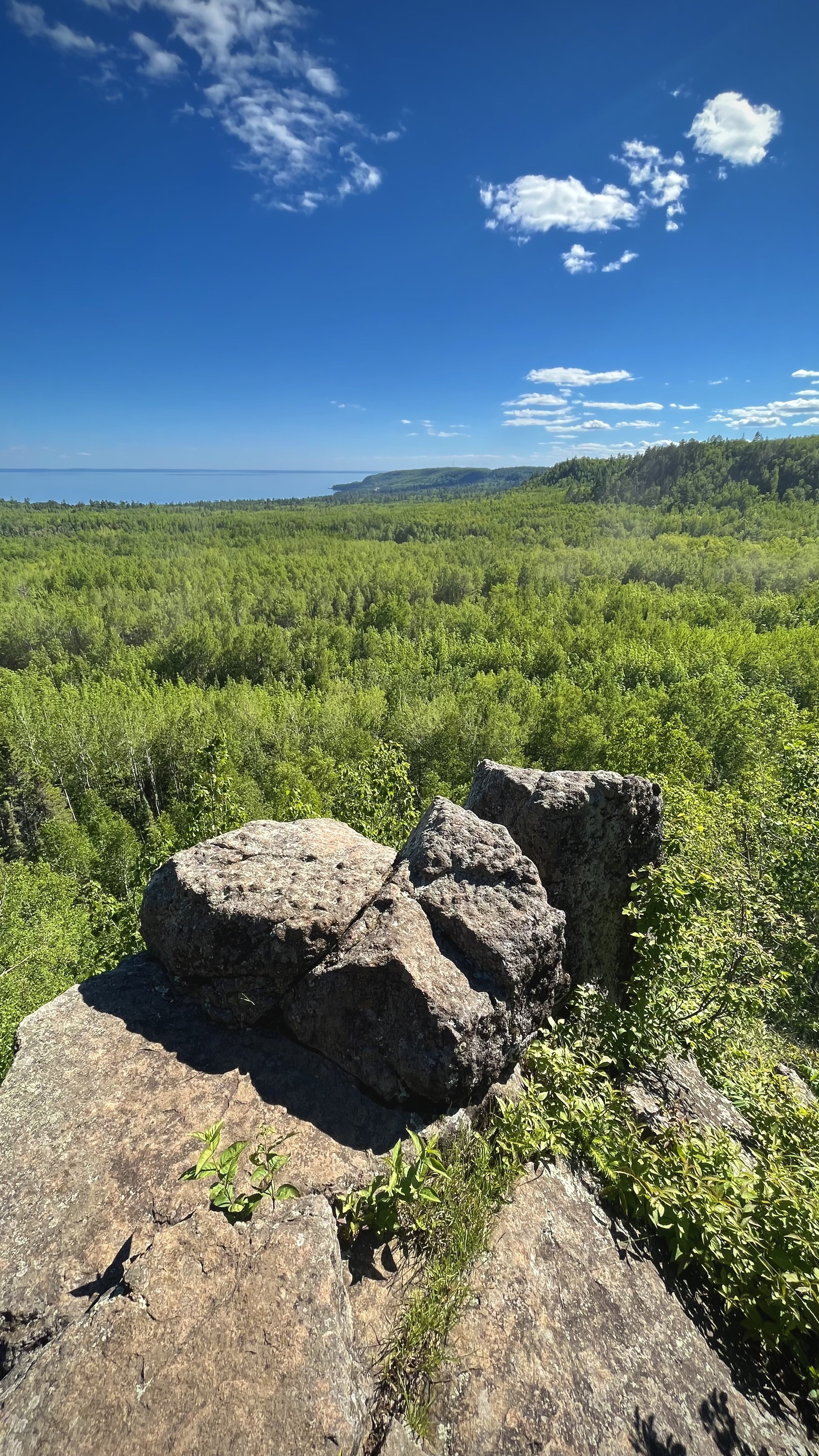
While I was talking with Dick, the landowner, my friend Justin drove by and picked me up. I said goodbye to Dick and got dropped off at the nearby trailhead where I re-supplied my food bag and caught up with Justin. It was a bummer he couldn’t join me again as his knees were still hurting him. I left Justin behind and continued on. It finally felt like I was on the real SHT now. After miles and miles of swamps, snowmobile trails and road walks, the trail finally gets into some elevation with overlooks and epic river crossings! Pine Ridge Overlook was my first actual overlook of the trip since Jay Cooke is mostly all grown in and Duluth was all fogged up. The sun was out now finally too and it just felt special up there on the overlook.

Crow Creek river crossing.
Coming down from Pine Ridge Overlook there’s two wet river crossings. The Encampment River was a nice river crossing. It wasn’t very deep but it was the widest crossing of the trip. Shortly after that was another crossing on Crow Creek which was really cool with massive canyon walls on both sides of the river! After crossing & climbing another ridge there was a great view from Wolf Rock.
Soon I got to my destination campsite at Crow Creek. I skipped the nearby overlook for now as I was planning on going there for sunset later on. The campsite got pretty crowded after I set up. By the time I went to bed there was around 20 people there! Again all of the SHT sites are to be shared with other hikers. I sat next to the fire for a bit and chatted with others before heading to the overlook. Shout out to Tucker who recognized me and follows me on Instagram. At the Crow Creek Valley Overlook I caught the last light of golden hour lighting up the valley below. Once I returned to camp I got into my tent and stretched out for a bit. I heard Maps & Poptart roll into camp and said hello through the tent before going to sleep. Glad I had earplugs with all of the people here. Thankfully most people are pretty respectful of others on trail and it quieted down around 10 after dark. I’m planning on getting up early tomorrow with the amount of people on trail this weekend. It also happens to be Grandmas Marathon tomorrow as well which is one of the biggest events on the North Shore drawing runners and spectators from all around the world. It’s going to be crazy busy especially at Gooseberry State Park which I’ll be passing through tomorrow and is already the most visited state park up here. I’m looking forward to staying one of my favorite campsites on the SHT tomorrow night though!

Crow Creek Overlook at sunset.
Trip Report from backpacking the 42 mile long Pictured Rocks National Lakeshore Trail. It follows sandy beaches and dramatic cliffs along Lake Superior in the Upper Peninsula of Michigan.