


By John Keefover of Keefography

BWCAW BACKPACKING EAGLE MOUNTAIN
Overnight trip at the highest point in Minnesota in the Boundary Waters Canoe Area Wilderness.
On this adventure we hiked to Eagle Mountain, the highest point in Minnesota at 2,301 feet, and camped out on a nearby lake in the Boundary Waters Canoe Area Wilderness. Eagle Mountain is located in Cook County in Northern Minnesota and is part of the Misquah Hills Mountain Range within the Canadian Shield. The summit is 1,700 feet above nearby Lake Superior. From the Eagle Mountain trailhead it’s a 3.5 mile hike to the top. The trail is pretty flat with a very gradual, subtle climb for the first 3 miles, and then steeply ascends up to the rocky top. The views are mostly obscured with grown-in trees, but there’s a few openings that make it worth it. Late September and early October would be the best time to visit for fall colors, and a little less leaves on the summit obstructing the view.
Being in the BWCAW you need a permit for both day-use and overnight hikes if backpacking between May and September. If going outside of those months, a self-filled day-use permit is all you need. Day-use permits can be filled out at the trailhead and are free. Overnight hiking & paddling trips need to be reserved through https://www.recreation.gov/ and cost $6 for the permit itself, and then $16 per adult or $8 for youth. Starting in 2022 the United States Forest Service reduced the number of entry point permits for the BWCAW citing natural resource damage, crowding and congestion. It’s important to Leave No Trace and protect this wilderness for generations to come! The Eagle Mountain trailhead entry point only has one overnight permit available each day. There is another nearby trailhead that has access to Eagle Mountain as well which would be the Brule Lake Trail that is 6.7 miles to the summit. It’s good to check both availabilities to see if there might be other people camping. There are two campsites on Whale Lake which is about a half mile before the top of Eagle Mountain, so if both trailhead permits are booked you’re both likely to have a spot to camp. Though the Northern campsite is much better.
If you enjoy this free content please consider making a CONTRIBUTION, buying my 2023 PHOTOGRAPHY CALENDAR, purchasing PRINTS, and following along on Social Media at Instagram, Facebook, & YouTube. Your support is greatly appreciated to help cover travel costs, permits, gear acquisitions, and time commitments needed to get outside and share these adventures with you all. Thank you! Now onto the trip itself:
EAGLE MOUNTAIN
Long and winding dirt road down the Caribou Trail leads to the Grade and eventually the Eagle Mountain Trailhead. It was almost completely full with cars parked on the side of the entrance even. I have never seen this many cars here! Hopefully it’s all just day hikers and the campsites are available. Like I said earlier though I have the only overnight permit here and no one booked the Brule Lake one today. Unless people reserved a permit for Friday or Saturday and are basecamping this holiday weekend.

Eagle Mountain Trailhead sign.
Starting out it’s a very rocky trail with a gradual uphill most of the way. Constantly need to watch your footing with every step. So many people heading back to the parking lot. Took forever waiting for groups to pass. One of the older couples walking past looked so surprised and curiously asked “are you sleeping out here?!” You bet.
Not long into the hike we crossed into the BWCAW border where there’s a sign letting you know. Being a wilderness trail it has very low maintenance. A lot of the boardwalks were in pretty rough shape. Bouncing around when stepping on them almost like teeter totter.

BWCAW Sign.
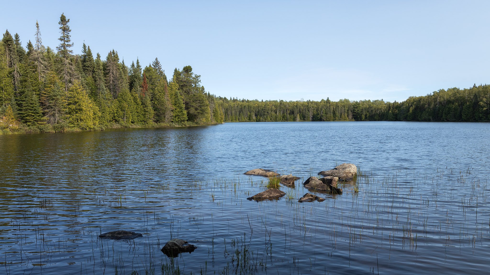
Eventually the trail opened up to Whale Lake. It’s a beautiful view right at the southern tip of the lake. There’s a very high chance of Aurora activity tonight and this spot is looking due North over the lake! Will definitely be coming back here to check later tonight. Especially with completely clear skies as well it’ll be amazing! This view has what looks Eagle Mountain behind the lake, but it’s actually it’s actually an unnamed peak that’s 80 feet shorter than Eagle Mountain which is just off to the Northwest.

Whale Lake and an unnamed peak in the background.
The trail continues following along with the lake. It was really pretty walking through here. Finally it felt like we were actually in the Boundary Waters now that we were by the water. With the amount of people on this trail though it honestly doesn’t really feel like the BWCAW to me. I like solitude when I’m out here. Sound travels far over water and you could hear multiple groups of people walking by constantly. Don’t expect peace and quiet when you’re out here. At least during the day. Once the day hikers head out it’ll be nice I’m sure. It is also Labor Day Weekend and every single place we passed on the way up here was super crowded. This trail is a more accessible way for most people to experience the Boundary Waters though so I’m all for it!
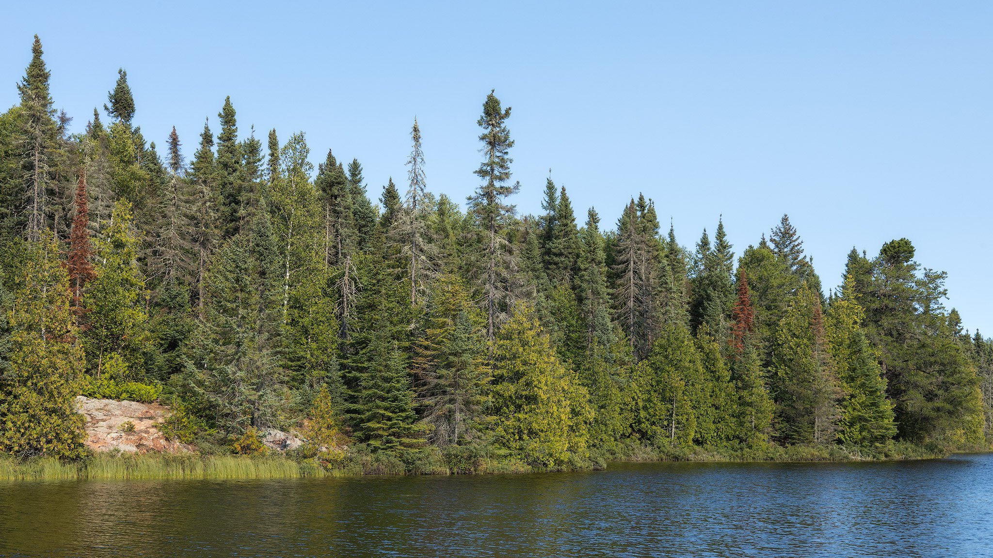
Once on the North side of the lake the trail comes to a fork. To the left takes you up to the summit. For now we went right on the Brule Lake Trail. The Northern campsite is just a short way down this trail along the lake. I do want to come back another time taking the Brule Lake Trail in for some different scenery. This is my second time backpacking the Eagle Mountain Trail side.

Luckily there was no one at the campsite we went to on the Northern side of the lake! It’s a beautiful spot on a peninsula right on the lake. Especially with the sun shining down on it now. We set up camp and gathered some firewood. Our plan was to chill for a bit before we head up to the summit with our dinners and watch the sunset. Then we’d have a fire back at camp while we wait for it to get dark and hopefully watch the northern lights! Dead & down wood was plentiful. No rain in some time so everything was perfectly dry. Even the birch which was everywhere. We’ll have an easy time getting a fire going later.

The Northern campsite on Whale Lake.
Heading up to the summit it’s a steep climb up compared to the gradual hill getting here. Very rocky too. Will be interesting hiking down in the dark with headlamps on! Once we got towards the top there’s an opening on a slanted slab of rock. Trees were obscuring the view but it was the first major overlook, and the moon was up in the sky well. Not far from there the view gets much better!

Trees & Moon as seen from the first overlook on Eagle Mountain.
From up here there’s a really nice view of 3 lakes and rolling hills around it. It’s a bit grown in as well but there’s a spot with a nice opening. Looking out into the great expanse in front of us was magical in the golden hour light. The only trace of man made objects in the entire view were some cell phone towers way off in the distance. Just trees, lakes and hills for miles.

Golden Hour on Eagle Mountain.
While there was still some sunlight we decided to go find the plaque marking the high point up here describing some of the history behind it.

Now we were getting hungry so we went back to our cliffside overlook. The sun was just about to set. I fired up the backpacking stove and boiled up some water for our freeze dried meals. While we waited for the meals to rehydrate I took some photos of the incredible sunset. The sun turned a bright red as it started to near the horizon line. There must be smoke drifting in from far away wildfires causing the sun to turn that color. As soon as it dipped below the trees most of the color in the sky went away, along with the light. That’s ok though it was time to eat!

Fiery sunset from Eagle Mountain.
After dinner and a snicker bar dessert we donned our headlamps to slowly make our way down the hill back to camp. There we had a fire until the true darkness when the moon set and the stars were out. We were hoping to catch the Northern Lights tonight. Our campsite on Whale Lake is on the northern side though so our view over the lake is facing south. While we were sitting around the fire though I noticed a white band out above the lake. I was curious so I pulled out my phone and was surprised to see it was S.T.E.V.E. (Strong Thermal Emission Velocity Enhancement) and the Picket Fence formations of the Aurora that typically appear in the Southern skies. It didn’t last very long but it was still very interesting. Unfortunately I only got cell phone shots of them.

S.T.E.V.E. & The Picket Fence.

S.T.E.V.E.
We burned the rest of the wood and put out the fire to go try our luck at a different vantage point on the other side of the lake. Not having cell phone service made predicting the Aurora difficult since I couldn’t reference any of the tracking apps or use other photographer’s sightings for reference. The big Northern Lights show seemed to be the night before. There was no aurora activity while we sat at this spot for an hour or so. That was a bummer but it was still so peaceful here. It was completely still, silent and peaceful. This is more like the BWCAW experience I’m used to. By this point we were both falling asleep while waiting for the northern lights so we decided to call it a night and go back to camp to sleep in the tent.
We were so tired we even slept right through sunrise! Oops. Needed that sleep I guess. I was planning on shooting sunrise right at the lake outside the tent, but that’s ok. We slowly packed up while eating some breakfast and drinking coffee. Fully enjoying ourselves and our time here. Throughout the early morning you could hear more and more groups of day-hikers walking on the trail across the lake towards Eagle Mountain. Around noon it was time for us to start heading back.
Thats it for this trip! Stay tuned for more BWCAW backpacking blogs in the near future as I’ll be hiking the Sioux-Hustler trail soon, and then the entire Border Route Trail in early October! Thanks for reading our quick overnight trip to the highest point in Minnesota. You should heck it out sometime!

Always good to have a paper map & GPS.
If you enjoy this free content please consider making a CONTRIBUTION, buying my 2023 PHOTOGRAPHY CALENDAR, purchasing PRINTS, and following along on Social Media at Instagram, Facebook, & YouTube. Your support is greatly appreciated to help cover travel costs, permits, gear acquisitions, and time commitments needed to get outside and share these adventures with you all. Thank you!
Trip Report from backpacking the 42 mile long Pictured Rocks National Lakeshore Trail. It follows sandy beaches and dramatic cliffs along Lake Superior in the Upper Peninsula of Michigan.